Reading the live feed from Caltrans...

Reading the live feed from Caltrans...
The north gate of the Eastern Sierra: Antelope Valley, the West Walker River canyon, and the high Bridgeport Valley.
Bridgeport and the Walker River conditions, cameras, and chain controls will show live here from Caltrans the moment the feed answers. Until then, check Caltrans QuickMap for the official word before you drive.
Caltrans is not returning checkpoint data for this stretch right now.
Every Caltrans chain checkpoint on this stretch, in the order you will meet them. The level is read from Caltrans's own posting for that checkpoint. What R-1, R-2, and R-3 require is on the chain guide.
No message is posted on this stretch's signs right now.
Caltrans reports no lane closures or incidents on this stretch right now.
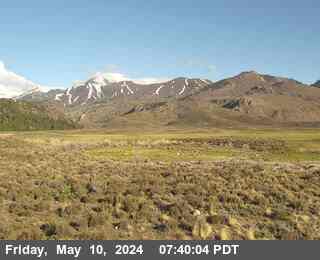
Coleville · 6,902 ft · Caltrans still image

Bridgeport · 6,486 ft · Caltrans still image
Bridgeport
Now: Mostly Sunny, 56°F, wind 5 to 10 mph SW.
Tonight: Partly Cloudy, 19°F.
Forecasts: National Weather Service, for each point itself.
This stretch picks US-395 up where California does, at the state line north of Topaz Lake, and runs it south through Coleville and Walker, up the West Walker River canyon, past the Sonora Pass junction, and into Bridgeport. It is the corridor's north gate, and its weather is valley and canyon weather: calmer than the summits ahead, but with ice that lingers in the canyon shade long after the open road has dried.
South of the state line the road enters Antelope Valley and the towns of Coleville and Walker, ranch country under the Sweetwater Mountains. Past Walker the highway narrows and follows the West Walker River through its canyon, one of the prettiest and twitchiest stretches on the corridor. The canyon holds shade late into the morning, so ice lingers on the pavement after the open valley has dried, and its rock walls shed debris after storms and freeze thaw cycles. In summer the same stretch stacks up with RVs and trailers headed for the campgrounds.
The road climbs out of the canyon to the junction with SR-108, the Sonora Pass road, which closes for the winter and usually reopens in late spring. Beyond it lies the Bridgeport Valley, a broad, high ranching basin with Bridgeport, the Mono County seat, at its south end. The SR-270 turnoff leads to the ghost town of Bodie. Bridgeport is the last full services stop before Lee Vining, and on storm days it is where southbound traffic stacks up waiting for Conway Summit controls to lift.
The live Caltrans feed is not answering right now, so check Caltrans QuickMap for the official word before you drive.
Is the road to Bridgeport open?
Check the live status at the top of this page, with its Caltrans timestamp. That status covers US-395 from the Nevada state line to Bridgeport, checkpoint by checkpoint.
Do I need chains between the state line and Bridgeport today?
Check the live checkpoint list on this page before you drive. Controls are less common on this stretch than at Conway Summit, but the Walker River canyon ices early and keeps ice late in the morning shade.
Is Sonora Pass open?
SR-108 over Sonora Pass closes for the winter and usually reopens in late spring. The junction sits on this stretch of US-395; check Caltrans QuickMap for the pass itself before planning on it.
Road, weather, and camera data: Caltrans District 9, the California Department of Transportation's Eastern Sierra district.